The Camino de Compostela in Luxembourg
A path from north to south
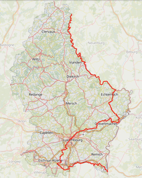
One of the aims of the “Frënn vum Camino de Santiago de Compostela” is to describe and signpost a Way of St. James across Luxembourg. This route is linked to the network established by the neighboring associations.
In the Middle Ages, pilgrims traveled along existing traffic routes, Roman roads and waterways.
In choosing the pilgrimage route, the “Frënn vum Camino de Santiago de Compostela” have made a compromise between past and present. The route is both practical and authentic. The route leads past places where the cult of St. James was cultivated in Luxembourg. Examples include the Jakobsberg near Berburg and the church in Roodt-Syr. Well-known pilgrimage sites, such as the grave of St. Willibrordus in Echternach or the places of pilgrimage that only emerged in modern times, such as Luxembourg Cathedral, are also integrated into the route.
As the route is used by modern pilgrims, it also takes into account today's catering and accommodation facilities.
The maintenance of the trail is ensured by the fact that it uses existing hiking trails maintained by local tourism organizations within the framework of the conditions mentioned above.
© Saarpfalz-Touristik, Manuela Meyer
The road
"Those who arrive on the Camino with a heavy heart leave it with a lighter burden."

© mobiliteit.lu
General
Public transport - Information - Signposting - Accommodation - Stages - Pilgrim's passport and stamp
Since March 1, 2020, public transport (train-bus-cable car-tram) has been free throughout the Grand Duchy of Luxembourg. On mobiliteit.lu you can find out all the connections.
On the pilgrimage route from Lieler to Schengen (approx. 180 km), we've linked accommodation options for each stage. We recommend that you book hotels, hostels, campsites, etc. in advance. If there aren’t any accommodation at the end of your stage, don't forget that you can travel free of charge by bus and train to accomodations further away.
For families with children and baby carriages, we recommend starting in Vianden. The route from Lieler to Vianden includes several passages which, in our opinion, are not suitable for baby carriages.
Signs on the path
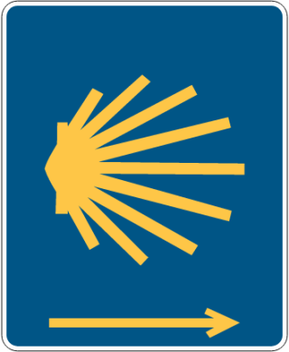
The blue and yellow scallop shell (in the vast majority of cases with an arrow indicating direction - if no arrow, always go in the direction of the radiating shell) accompanies you as a signpost throughout Europe.
If no shell or sticker can be applied, follow the yellow arrow (path, rocks, stones, walls, trees, etc.). However, we strongly recommend that you take a look at a map, especially at crossroads with numerous possible junctions. The exact route is also available at
geoportal.lu - Tourisme - Chemins de randonnée - Chemin St Jacques de Compostelle.
How do I get to Lieler?
Take the train to Clervaux. At the bus station, take the Bus No. 163 to Lieler (about 30 minutes) and get off at the “Schull” bus stop.
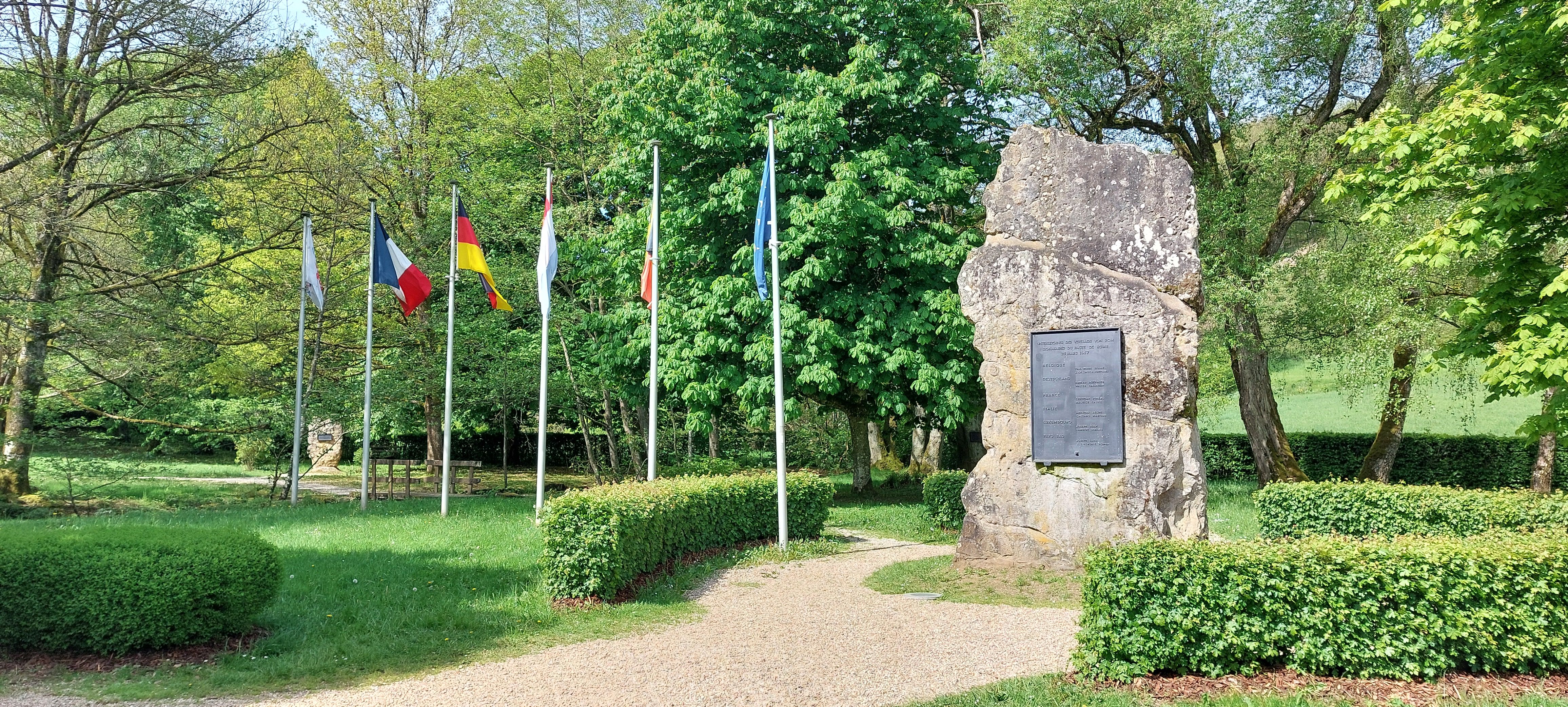
From here, follow the shell signs. You now have to descend into the valley for about 2 km, in the direction of the “Trois Frontières” (Ouren). The actual Camino de Santiago de Luxembourg begins at the meeting point of the three borders (Monument de l'Europe).
Stage 1:
From Lieler to Rodershausen (18 km)
Europadenkmal Ouren
© René Hulten
The first stage is the shortest but also the most difficult. You'll be walking on narrow paths and overcoming several meters of ascent and descent.
The start is in Lieler (commune of Clervaux), near the church. The route takes you to Ouren via a road to the European monument at the junction of the 3 borders (Luxembourg-Germany-Belgium). In the direction of Dasburg, you walk largely through forest on narrow paths along the right bank of the Our, passing the Kalborn mill with the river mussel station and the Tintesmühle mill at the campsite. Near Dasburg, you leave the shady forest and walk along the N10 road to Rodershausen (Parc Hosingen municipality).
Accommodation options are available here:
https://www.visit-eislek.lu/de/ihren-besuch-planen/unterkuenfte-im-eislek
You can download GPX data for this stage here.
Stage 2:
From Rodershausen to Bettel (24 km)
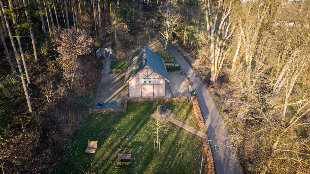
Bettel
© tandel.lu
From Rodershausen, the route to Stolzembourg runs alongside the River Our and the N10 road. If you wish to walk a further 3 km, you can make a detour to Bivels, the birthplace of Adrien Ries, the first modern-day Luxembourg pilgrim who made the pilgrimage on foot from Luxembourg to Santiago de Compostela.
Before the bridge over the Our, on the right, the path disappears again into the forest and climbs the hill to the chapel of the Virgin “Veianer Bildchen”. You pass Vianden Castle on the cycle path of the old “Benni” narrow-gauge railroad to Bettel (municipality of Tandel).
Accommodation options are available here:
https://www.visit-eislek.lu/de/ihren-besuch-planen/unterkuenfte-im-eislek
You can download GPX data for this stage here.
Rodershausen to Bettel via Bivels (+ 3km)
Rodershausen to Bettel
Stage 3:
From Bettel to Echternach (25 km)
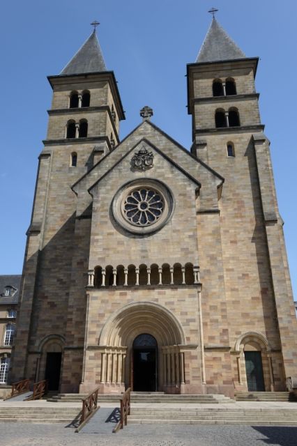
Sankt Willibrodus Basilika Echternach
© Roger Nilles
You leave Bettel on the N10, which is not very busy here either. After Hoesdorf, take the dirt road and make a detour into Germany at Wallendorf. Back in Luxembourg, at Wallendorf-Pont, you join the cycle path that runs alongside the N10 on the former Diekirch-Echternach railroad line. Follow this cycle path all the way to Echternach.
Along the way, you pass through the villages of Dillingen, Grundhof and Bollendorf. The destination of the stage is the tomb of Saint Willibrord in the Echternach basilica. Further information: www.basilika.lu
You can find accommodation options here:
You can download the GPX data for this stage here.
Stage 4:
From Echternach to Grevenmacher (22km)
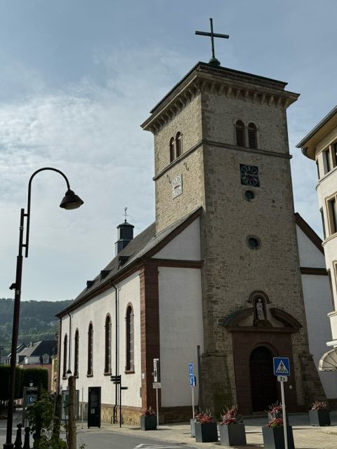
Sankt Laurentius Kirche Grevenmacher
© Dani Mackel
From Echternach, the path leads past the Echternach lake, up the hill into the forest and on to Geyershof. You then pass the “Jokesbierg”, where many years ago there was a chapel of St. James with a hermitage. After the villages of Berbourg and Manternach, you climb towards Münschecker.
After about 4 km, you arrive in the town of Grevenmacher, where the “Frënn vum Camino de Santiago de Compostela” have their headquarters.
Here, you can contact the secretariat of the parish Musel a Syr, Saint-Jacques.
Address: 4, rue de Luxembourg, to have your pilgrim's booklet stamped (Info:
You can find accommodation options here:
https://visitmaacher.lu/unterkuenfte/ferienwohnungen-camping/
You can download the GPX data for this stage here.
Stage 5:
From Grevenmacher to Senningen (22 km)
You leave Grevenmacher, passing the “Kräizkapell” in the direction of Potaschberg. From here, you're not far from Wecker. The path crosses Wecker and then follows a dirt track to Berg. At the town hall, turn right towards Betzdorf. After Betzdorf, the cycle path leads to Olingen and Roodt/Syr, where is also a church dedicated to St. James.
Along the way, you'll see the satellite dishes of satellite operator SES S.A., whose headquarters are in Betzdorf Castle.
From Roodt/Syr, take the dirt road to Niederanven, then on to Senningen (Niederanven municipality).
Accommodation options are available here:
You can download the GPX data for this stage here.
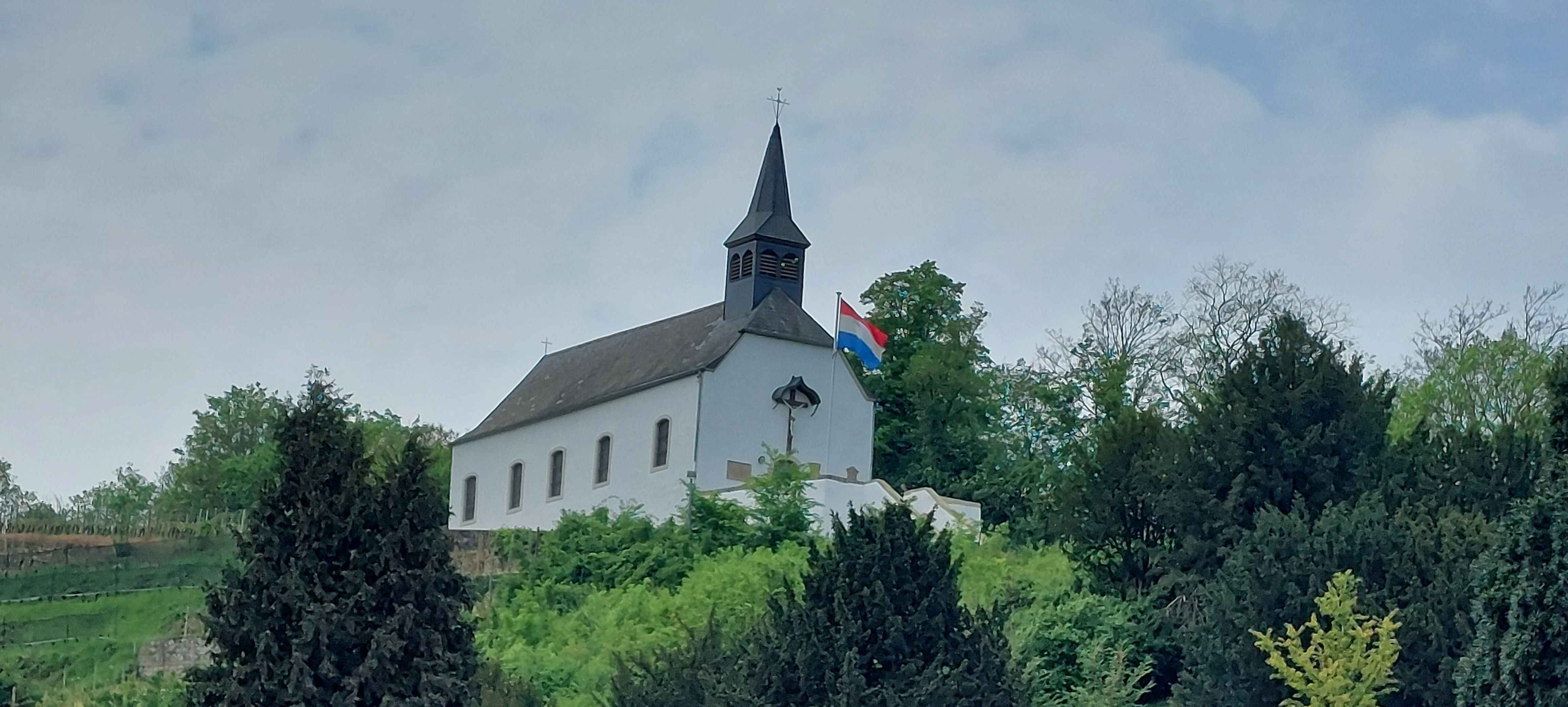
Kräizkapell Grevenmacher
© René Hulten
Stage 6:
From Senningen to Leudelange (22,6 km)
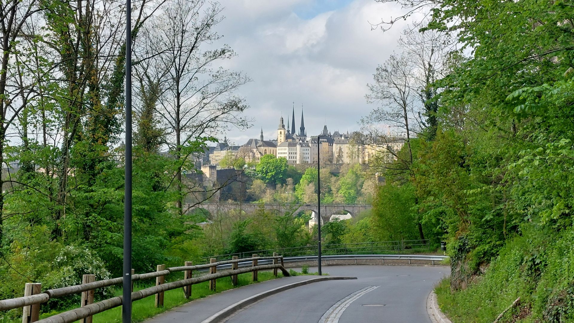
Stadt Luxembourg
© René Hulten
From Senningen, you climb a steep slope to Senningerberg, then cross the “Gréngewald” to Kirchberg. Passing the “Coque” sports center, you leave Kirchberg in the direction of Grund. On the way, you'll pass the Malakoff Tower and Robert Schuman's birthplace (Robert Schuman was French Prime Minister and later one of the founding fathers of Europe).
Next, past the youth hostel at the foot of the historic city center in the Pfaffenthal, you cross Neumünster up the steeply sloping “Breedewee” to the fish market and Notre-Dame Cathedral. Notre-Dame de Luxembourg Cathedral is the Roman Catholic place of worship of the city of Luxembourg and the cathedral church of the archbishop. It houses the statue of the Consolatrice des Affligés, venerated since the 17th century.
You leave Luxembourg City via the Pétrusse valley in the direction of Cessange. After the district of Cessange, you walk towards the Kockelscheuer forest, which you leave on the dirt road towards Leudelange (commune of Leudelange).
You can find accommodation options here:
You can download the GPX data for this stage here.
Stage 7:
From Leudelange to Hellange (23,8 km)
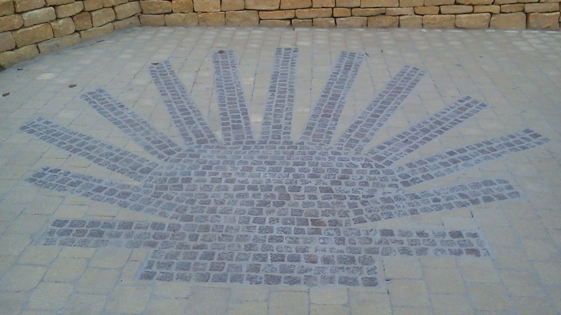
Jakobsmuschel Budersberg
© René Hulten
The route takes you from Leudelange through the Bettembourg forest to Huncherange. Then past the Huncherange mill to Noertzange and along the freeway to the “Toussaint” mill.
Then Budersberg and its large scallop shell are on your way. You pass through Dudelange to the “Kräizbierg”, then through the “Waal” forest region along the French border to Hellange (commune of Frisange).
You can find accommodation options here:
https://www.visitminett.lu/de/reisefuhrer/restaurants-hotels
You can download the GPX data for this stage here.
Stage 8:
From Hellange to Schengen (24,5 km)
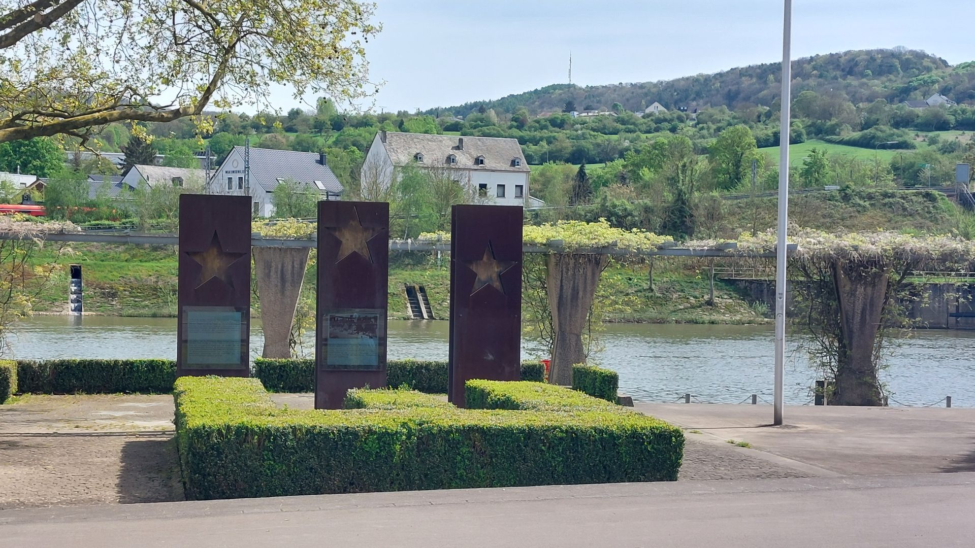
Monument "Schengener Abkommen" Schengen
© René Hulten
From Hellange, the route follows the Saar freeway to Frisange. After a brief detour into France via Evrange, the route follows the Franco-Luxembourg border to near Aspelt.
You return to Luxembourg territory and pass the “Kaaschtel” in the direction of Mondorf-les-Bains. After leaving Mondorf, you cross several kilometers of fields and meadows before reaching Elvange. You cross the famous “Biirenallee” and see Remerschen and the Schengen destination in the distance, where the Schengen Agreement was signed in 1985.
You can find accommodation options here:
https://www.visitmoselle.lu/de/plan-your-stay/uebernachten
You can download the GPX data for this stage here.
Tips & Links
Where can I obtain a pilgrim's passport (Credencial)?
The pilgrim's book or Credencial del Peregrino
The pilgrim's book is a kind of pilgrim's passport, to be stamped at each stage of the journey. Today's carnet dates back to the written document issued to pilgrims in the Middle Ages as a form of safe-conduct. The pass must be stamped at least once a day, and at least twice a day for the last 100 km (for pilgrims on foot or horseback) or 200 km (for pilgrims on bicycle) or 100 nautical miles. In addition, they must have walked the last few kilometers of the pilgrimage from O Monte do Gozo. Only carnets issued by the Pilgrims' Office are officially valid.
You can order the official edition of the Cathedral of Santiago de Compostela in the store :
Where can I get my carnet stamped?
Have your pilgrim's passport date-stamped at the place where you are staying overnight (e.g. hotel, youth hostel, campsite). You can also ask at the tourist office, town hall, parish priest or secretariat.
There are no rules about who can issue a stamp. It doesn't have to be a church stamp or a scallop shell.
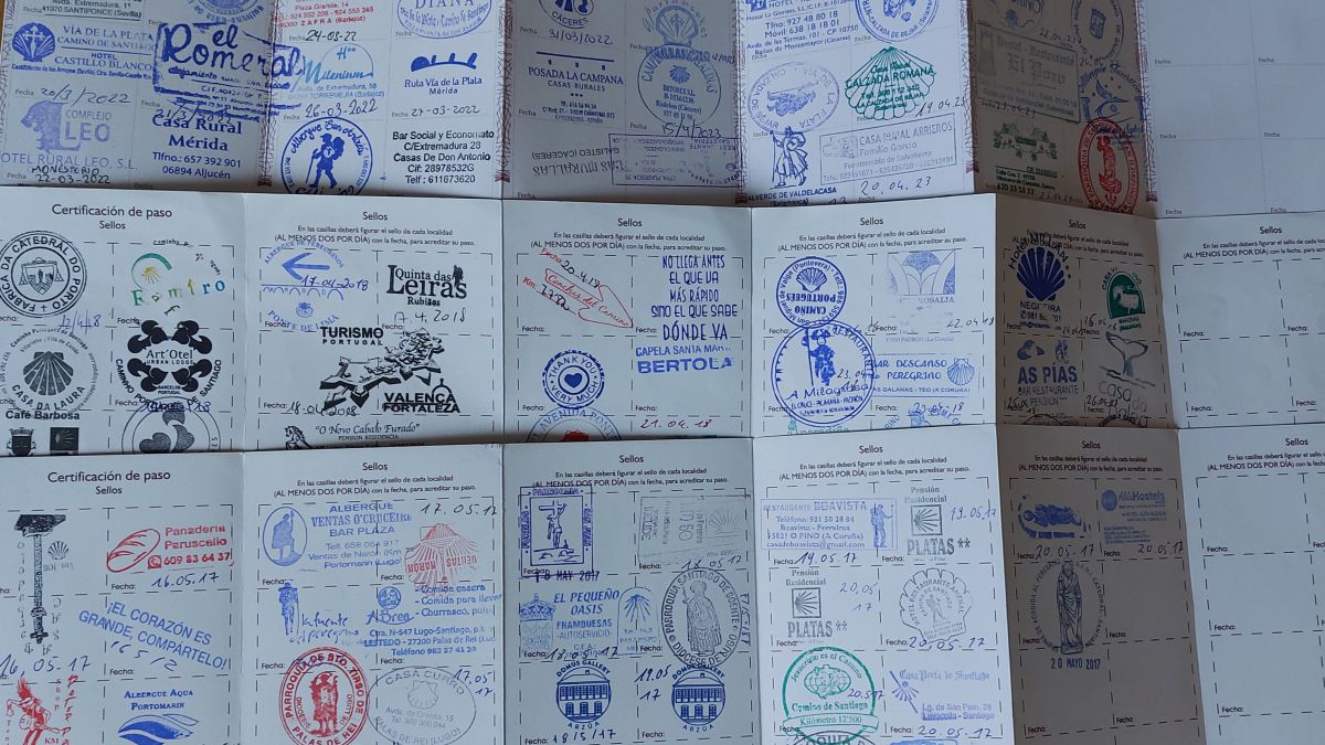
© René Hulten
 EN
EN  DE
DE  FR
FR 